Region

Ski areas in Valais

24 ski areas in Valais with 2,425 kilometres of piste in total. Sorted by size, with seasonal status, key figures and piste map.
24Resorts
2,425Slope km
3883Highest point (m)
CHF 42Cheapest day pass
Landscape near Champéry / Portes du Soleil (CH) …

Champéry / Portes du Soleil (CH)

Valais
600Slope km
1050–2277Elevation m
CHF 62Day pass
🗓 Dec – April
Landscape near Verbier / 4 Vallées … 🧊

Verbier / 4 Vallées

Valais
410Slope km
1500–3330Elevation m
CHF 92Day pass
🗓 Nov – April
Landscape near Zermatt – Matterhorn … 🧊

Zermatt – Matterhorn

Valais
360Slope km
1620–3883Elevation m
CHF 92Day pass
🗓 year-round
Landscape near Crans-Montana … 🧊

Crans-Montana

Valais
140Slope km
1500–3000Elevation m
CHF 85Day pass
🗓 Dec – April
Landscape near Grimentz-Zinal …

Grimentz-Zinal

Valais
106Slope km
1570–2900Elevation m
CHF 66Day pass
🗓 Dec – April
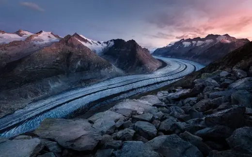
Landscape near Aletsch Arena …

Aletsch Arena

Valais
104Slope km
1050–2869Elevation m
CHF 77Day pass
🗓 Dec – April
Landscape near Saas-Fee … 🧊

Saas-Fee

Valais
100Slope km
1800–3500Elevation m
CHF 87Day pass
🗓 mid-July – April
Landscape near Saint-Luc / Chandolin …

Saint-Luc / Chandolin

Valais
75Slope km
1650–3025Elevation m
CHF 62Day pass
🗓 Dec – April
Landscape near Anzère …

Anzère

Valais
58Slope km
1500–2420Elevation m
CHF 59Day pass
🗓 Dec – April
Landscape near Leukerbad – Torrent …

Leukerbad – Torrent

Valais
50Slope km
1411–2700Elevation m
CHF 68Day pass
🗓 Dec – April
Landscape near Belalp – Blatten …

Belalp – Blatten

Valais
44.8Slope km
1327–3118Elevation m
≤ CHF 77Day pass
🗓 Dec – April
Landscape near Grächen …

Grächen

Valais
44Slope km
1619–2868Elevation m
CHF 64Day pass
🗓 Dec – April
Landscape near Evolène …

Evolène

Valais
42Slope km
1400–2680Elevation m
CHF 48Day pass
🗓 Dec – April
Landscape near Lauchernalp – Lötschental …

Lauchernalp – Lötschental

Valais
40Slope km
1403–3100Elevation m
CHF 70Day pass
🗓 Dec – April
Landscape near Vercorin …

Vercorin

Valais
35Slope km
1340–2377Elevation m
CHF 52Day pass
🗓 Dec – April
Landscape near Saas-Grund – Hohsaas … 🧊

Saas-Grund – Hohsaas

Valais
34Slope km
1560–3200Elevation m
CHF 60Day pass
🗓 Dec – April
Landscape near Bellwald …

Bellwald

Valais
30Slope km
1560–2560Elevation m
CHF 52Day pass
🗓 Dec – April
Landscape near Ovronnaz …

Ovronnaz

Valais
30Slope km
1350–2500Elevation m
CHF 50Day pass
🗓 Dec – April
Landscape near Moosalp – Bürchen/Törbel …

Moosalp – Bürchen/Törbel

Valais
25Slope km
1450–2550Elevation m
CHF 53Day pass
🗓 Dec – March
Landscape near Les Marécottes …

Les Marécottes

Valais
25Slope km
1100–2200Elevation m
CHF 48Day pass
🗓 Dec – April
Landscape near Rosswald …

Rosswald

Valais
20Slope km
1800–2560Elevation m
CHF 42Day pass
🗓 Dec – April
Landscape near Visperterminen – Giw …

Visperterminen – Giw

Valais
20Slope km
1340–2300Elevation m
CHF 53Day pass
🗓 Dec – March
Landscape near Nax – Mont-Noble …

Nax – Mont-Noble

Valais
20Slope km
1300–2340Elevation m
CHF 44Day pass
🗓 Dec – April
Landscape near Arolla …

Arolla

Valais
12Slope km
1950–2890Elevation m
CHF 42Day pass
🗓 Dec – April

Figures are guide values still being verified. Status means seasonal status, not a live status.

How Valais compares

Valais is the largest ski canton in Switzerland: 24 areas with 2,425 kilometres of piste between them, 38.0 per cent of the national total. The biggest single area is Champéry / Portes du Soleil (CH) with 600 km (whole Portes du Soleil area including France, Swiss share around 100 km).

The areas sit at a median weighted altitude of 2,002 metres, 228 metres above the Swiss median of 1,774 metres. That figure weights the base station at 60 per cent and the top station at 40, because snow disappears at the bottom first. It is a choice rather than a measurement, and it knows nothing about aspect, snowmaking or where the storms actually go. Terrain here runs from 1,050 to 3,883 metres.

A day pass costs CHF 61 at the median, essentially the Swiss median of CHF 58. The cheapest single area is Rosswald at CHF 42.

The season runs 5 months at the median. 5 areas sit on a glacier, and 2 of them run in summer as well.

Zermatt – Matterhorn glacier, weighted 2,525 m
1,620–3,883 m
Saas-Fee glacier, weighted 2,480 m
1,800–3,500 m
Arolla weighted 2,326 m
1,950–2,890 m
Verbier / 4 Vallées glacier, weighted 2,232 m
1,500–3,330 m
Saas-Grund – Hohsaas glacier, weighted 2,216 m
1,560–3,200 m
Saint-Luc / Chandolin weighted 2,200 m
1,650–3,025 m
Grächen weighted 2,119 m
1,619–2,868 m
Rosswald weighted 2,104 m
1,800–2,560 m
Grimentz-Zinal weighted 2,102 m
1,570–2,900 m
Crans-Montana glacier, weighted 2,100 m
1,500–3,000 m
Lauchernalp – Lötschental weighted 2,082 m
1,403–3,100 m
Belalp – Blatten weighted 2,043 m
1,327–3,118 m
Bellwald weighted 1,960 m
1,560–2,560 m
Leukerbad – Torrent weighted 1,927 m
1,411–2,700 m
Evolène weighted 1,912 m
1,400–2,680 m
Moosalp – Bürchen/Törbel weighted 1,890 m
1,450–2,550 m
Anzère weighted 1,868 m
1,500–2,420 m
Ovronnaz weighted 1,810 m
1,350–2,500 m
Aletsch Arena weighted 1,778 m
1,050–2,869 m
Vercorin weighted 1,755 m
1,340–2,377 m
Visperterminen – Giw weighted 1,724 m
1,340–2,300 m
Nax – Mont-Noble weighted 1,716 m
1,300–2,340 m
Champéry / Portes du Soleil (CH) weighted 1,541 m
1,050–2,277 m
Les Marécottes weighted 1,540 m
1,100–2,200 m
Shared scale from 1,000 to 4,000 m. Each bar shows where the terrain begins and ends, not just its highest point. Where the terrain of each area in Valais begins and ends, sorted by weighted altitude, highest first. Glacier areas are named as such in the label and carry a lighter bar. The Swiss median weighted altitude is 1,774 metres. Our own calculation from the elevations published by the lift companies, as of summer 2026. Weighted altitude is 60 per cent base station plus 40 per cent top station.

← All regions To the full map