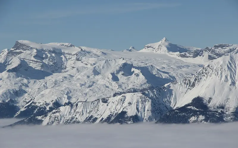
.jpg)
Vercorin lies in Valais and is a small, family-run ski area: 35 kilometres of piste served by 9 lifts.
The area runs from 1340 to 2377 metres above sea level, giving around 1,037 metres of vertical. The high starting point helps when there is no snow down in the valley.
The season usually runs Dec – April.
An adult day pass costs CHF 52.
Of note: Sun balcony above the Rhone valley
Pistes by difficulty
- Leicht (blau)15 km42%
- Mittel (rot)18 km51%
- Schwer (schwarz)2 km7%
Distribution calculated from OpenStreetMap and applied to the 35 official kilometres of piste. An approximation, not a figure from the lift company.
Snow report
Not currentThis reading is 47 days old and is not being updated automatically at the moment. Current figures are available from the SLF and from the resort itself.
Source: SLF / WSL Institute for Snow and Avalanche Research. A single measuring station, not the resort’s official piste report.
Piste map, map & webcams
Interactive piste map
Every piste and lift colour-coded by difficulty, zoomable, built on OpenStreetMap. Community-maintained data; where it differs, the official piste map next to it is authoritative.
Open on OpenSkiMap →Official piste map
The lift company’s drawn piste map, plus lift status and tickets.
vercorin.ch →Webcams
Live images from the mountain on the resort’s official site, usually several locations.
View webcams →Piste maps and webcam images belong to the lift companies and are protected by copyright. That is why we link directly to the original instead of copying it.
What sets this ski area apart
Vercorin sits on a mountain terrace at 1330 metres above Sierre and belongs politically to the municipality of Chalais. Above the village rises the Crêt du Midi, the northernmost summit of the chain separating the Val de Réchy from the Val d'Anniviers.
The place stayed remote for a remarkably long time: there has been a road only since 1938, a cable car since 1951, and the present installation with two 15-person cabins since 1989. Before that, mule tracks were the way in.
As on many Valaisian sun-facing slopes, everything here depends on water. The 6.3-kilometre Bisse de Vercorin was built in the fourteenth century and still carries water from the Rèche out of the Val de Réchy onto the meadows. The old village core of timber houses and granaries stands tightly around the Romanesque bell tower and the Gothic choir of 1520.
Sources: de.wikipedia.org/wiki/Vercorin
Getting there by public transport
Destination stop: Vercorin, poste. Fastest connection on a Saturday morning in the currently published timetable, from the open Swiss timetable interface, retrieved 10 August 2026. A guide value, not a timetable: the real journey time depends on when you leave and what you connect to, and winter-only bus services are not yet included.
Frequently asked about Vercorin
How high is Vercorin?
The ski area runs from 1,340 to 2,377 metres above sea level, a vertical range of 1,037 metres. For snow reliability the lower figure matters more: that is where the snow disappears first, and where a mild December is felt before it is felt at the top.
How many kilometres of piste does Vercorin have?
35 kilometres on 9 lifts, according to the operator. There is no binding standard for measuring piste kilometres, so the figure is comparable between resorts only to a point. The lift count says at least as much about how big a place feels.
What does a day pass at Vercorin cost?
CHF 52 for an adult day pass at the standard rate, as of summer 2026. Booked early it is often less; on a peak Saturday it is not.
When does Vercorin open?
The usual season window is Dec – April. No starting date has been announced for winter 2026/27 yet. Most resorts commit only in the autumn, because a postponed opening costs more goodwill than a late announcement.
How do I get to Vercorin by train?
The destination stop is Vercorin, poste. From Zürich HB the fastest connection on a Saturday morning takes 3 h 34, changing 3 times; from Bern 2 h 29. A guide value, not a timetable.
Vercorin in the magazine
Where this resort stands
Vercorin is one of 24 ski areas in the canton of Valais, and it is quickest reached from Bern by train, in 2 h 29.
Nearby ski areas
Distances are straight-line, not driving time. In the Alps a ridge between two valleys can turn 12 km into a two-hour drive.
Key figures
- Region
- Valais
- Season
- Dec – April
- Kilometres of piste
- 35 km
- Elevation
- 1340 to 2377 m (1,037 m of vertical)
- Lifts
- 9
- Adult day pass
- around CHF 52 (guide value)
- Summer skiing
- no
- Glacier
- no
- Snow park
- rated 3/10
- Coordinates
- 46.255, 7.535
- Official website
- vercorin.ch
All values are guide figures still being verified. For day-to-day information, use the resort’s official website.