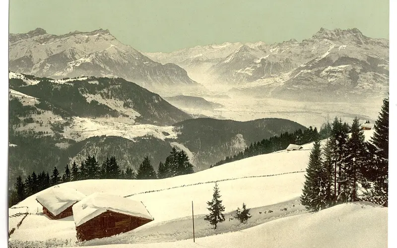

Champéry / Portes du Soleil (CH) lies in Valais and ranks among the large ski networks of the Alps: 600 kilometres of piste served by 35 lifts.
The area runs from 1050 to 2277 metres above sea level, giving around 1,227 metres of vertical. The lower slopes depend on snowmaking in mild winters.
The season usually runs Dec – April.
There is a snow park, an adult day pass costs CHF 62.
Of note: 600 km spanning the border with France
Pistes by difficulty
- Leicht (blau)366 km61%
- Mittel (rot)180 km30%
- Schwer (schwarz)54 km9%
Distribution calculated from OpenStreetMap and applied to the 600 official kilometres of piste. An approximation, not a figure from the lift company.
Snow report
Not currentThis reading is 47 days old and is not being updated automatically at the moment. Current figures are available from the SLF and from the resort itself.
Source: SLF / WSL Institute for Snow and Avalanche Research. A single measuring station, not the resort’s official piste report.
Piste map, map & webcams
Interactive piste map
Every piste and lift colour-coded by difficulty, zoomable, built on OpenStreetMap. Community-maintained data; where it differs, the official piste map next to it is authoritative.
Open on OpenSkiMap →Official piste map
The lift company’s drawn piste map, plus lift status and tickets.
regiondentsdumidi.ch →Webcams
Live images from the mountain on the resort’s official site, usually several locations.
View webcams →Piste maps and webcam images belong to the lift companies and are protected by copyright. That is why we link directly to the original instead of copying it.
Snow’n’Rail at Champéry / Portes du Soleil (CH): up to 30% off the ski pass
This resort takes part in Snow’n’Rail, the combined offer from SBB RailAway: book the journey and the ski pass together and the pass costs less.
Snow’n’Rail Portes du Soleil at SBB →All resorts with Snow’n’Rail →
Getting there by public transport
Destination stop: Champéry. Fastest connection on a Saturday morning in the currently published timetable, from the open Swiss timetable interface, retrieved 10 August 2026. A guide value, not a timetable: the real journey time depends on when you leave and what you connect to, and winter-only bus services are not yet included.
Worth knowing: this resort is in the Snow’n’Rail scheme, so the lift pass is up to 30 per cent cheaper if you arrive this way. From Genève that is 2 h 32 on the train instead of behind the wheel.
Frequently asked about Champéry / Portes du Soleil (CH)
How high is Champéry / Portes du Soleil (CH)?
The ski area runs from 1,050 to 2,277 metres above sea level, a vertical range of 1,227 metres. For snow reliability the lower figure matters more: that is where the snow disappears first, and where a mild December is felt before it is felt at the top.
How many kilometres of piste does Champéry / Portes du Soleil (CH) have?
600 kilometres on 35 lifts, according to the operator. There is no binding standard for measuring piste kilometres, so the figure is comparable between resorts only to a point. The lift count says at least as much about how big a place feels.
What does a day pass at Champéry / Portes du Soleil (CH) cost?
CHF 62 for an adult day pass at the standard rate, as of summer 2026. Booked early it is often less; on a peak Saturday it is not. Arriving by public transport takes up to 30 per cent off through the Snow’n’Rail scheme.
When does Champéry / Portes du Soleil (CH) open?
The usual season window is Dec – April. No starting date has been announced for winter 2026/27 yet. Most resorts commit only in the autumn, because a postponed opening costs more goodwill than a late announcement.
How do I get to Champéry / Portes du Soleil (CH) by train?
The destination stop is Champéry. From Zürich HB the fastest connection on a Saturday morning takes 4 h 08, changing 2 times; from Bern 3 h 06. A guide value, not a timetable.
Is there Snow’n’Rail at Champéry / Portes du Soleil (CH)?
Yes. Champéry / Portes du Soleil (CH) is one of the destinations in SBB RailAway's combined offer: book the journey and the ski pass together and the pass costs up to 30 per cent less. At SBB the destination is listed as Portes du Soleil. That percentage is the maximum SBB advertises; what actually comes off depends on the ticket type and the date, and only SBB can tell you bindingly.
Champéry / Portes du Soleil (CH) in the magazine
Where you can practise transceiver searching: 27 facilities in Switzerland
More than two dozen Swiss ski areas have a permanent practice facility for avalanche transceiver searching. Use is mostly free and needs only a valid lift pass. The complete list, linked to our resort pages, and what such a facility can do.
Is the Magic Pass worth it? The maths with real numbers
The Magic Pass currently costs CHF 482 and covers 95 stations. We worked out how many ski days it takes to break even: ten. And checked which resorts are actually included. Of Switzerland's fifteen largest ski areas, two are.
Snow'n'Rail: every Swiss resort in the scheme, and what it actually saves
All 27 SBB Snow'n'Rail destinations with verified discounts, plus the arithmetic on when taking the train really pays. Between CHF 5 and CHF 28 a day, and that is not the whole difference.
What does skiing in Switzerland actually cost?
Day passes from CHF 40 to 95, median 58. What a ski day really costs once you add travel and food, where you get the most piste per franc, and which discounts are worth it. Numbers from all 85 resorts.
Where this resort stands
In our rankings of all Swiss ski areas:
Champéry / Portes du Soleil (CH) is one of 24 ski areas in the canton of Valais, and it is quickest reached from Geneva by train, in 2 h 32.
Nearby ski areas
Distances are straight-line, not driving time. In the Alps a ridge between two valleys can turn 12 km into a two-hour drive.
Key figures
- Region
- Valais
- Season
- Dec – April
- Kilometres of piste
- 600 km
- Elevation
- 1050 to 2277 m (1,227 m of vertical)
- Lifts
- 35
- Adult day pass
- around CHF 62 (guide value)
- Summer skiing
- no
- Glacier
- no
- Snow park
- rated 6/10
- Coordinates
- 46.176, 6.869
- Official website
- regiondentsdumidi.ch
All values are guide figures still being verified. For day-to-day information, use the resort’s official website.